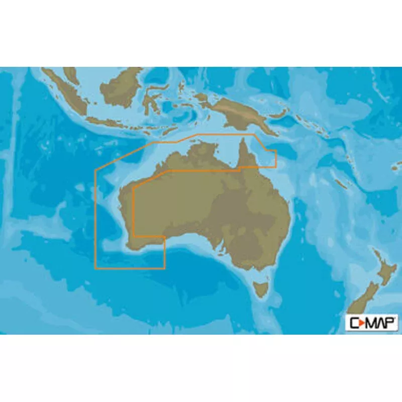
Cruising, fishing or sailing, C-MAP; REVEAL charts offer the very best of C-MAP. With Shaded Relief, including game-changing Reveal Seafloor Imagery, Aerial Photography, Satellite Overlay and Dynamic Raster Chart presentation added to the core C-MAP features found in DISCOVERfull-featured Vector Charts, with Custom Depth Shading, Tides & Currents and subscription-free Easy Routing. It also includes the very best of C-MAP High-Res Bathy, including integrated Genesis; data. Purchase includes a full 12 months of free online updates.
Compatible with Lowrance, Simrad & B&G Chartplotters.
- Shaded Reliefbring the world around you to life, with 3D rendered land and underwater elevationincluding areas of Ultra-High-Res Bathymetric seafloor imagery, previously only available in MAX-N+ Reveala game-changer for anglers and divers.
- Full Featured Vector Chartsmaking navigation easy by giving you accurate, up-to-date vector chart detail derive from official Hydrographic Office information.
- High-Res Bathyhelps you identify shallow areas, drop-offs, ledges, holes or humps. Now includes compiled and quality-controlled Genesis; detail as part of singular HRB layer.
- Custom Depth Shadingset a clear safety depth, maintain a paper-like view or create your own custom shading.
- Dynamic Raster Chartsproviding the traditional chart look and feel, coupled with easy access to all objects on the chart.
- Easy Routinghelps you automatically plot the shortest, safest route based on detailed chart data and your personalized vessel information.
- Aerial Photographya collection of thousands of photos of marinas, harbors, inlets and other notable navigational features included to offer an additional level of detail.
- Satellite Overlaysatellite imagery gives information about the surroundings when you find yourself in an unfamiliar place.
- Tides & Currentsshows projections of water level and direction of tides to help plan your day out, cruising, angling or sailing.
- Detailed Marina Port Plansdocking in an unfamiliar port is no problem when you have precise layouts of thousands of marinas, including slip spaces, restricted areas and other valuable navigation information.
- Harbor & Approach Detailsunprecedented level of detail. Approach any harbor and inlet with confidence. The perfect conclusion to a long voyage, sailing adventure or an exciting day of fishing.
- Online Updateskeep your chart up to date, with 12 months free online updates
![Sea-Dog Stainless Steel Case Hose Deck Fill Fits 1-1/2" Hose - Diesel [351321-1]](https://www.topfishinggeardirect.com/wp-content/uploads/2026/09/sea-dog-stainless-steel-case-hose-deck-fill-fits-1-1-2-hose-diesel-351321-1.webp)

![Sea-Dog Nylon Deck Hinge - Black [273200-1]](https://www.topfishinggeardirect.com/wp-content/uploads/2026/09/sea-dog-nylon-deck-hinge-black-273200-1.webp)
![Sea-Dog Triple Threat Three Pole Rod Holder - Flat Dark Earth [325034-1]](https://www.topfishinggeardirect.com/wp-content/uploads/2026/09/sea-dog-triple-threat-three-pole-rod-holder-flat-dark-earth-325034-1.webp)